Land Survey Details for Sattva Aangane
Featured Image of Land Survey Details for Sattva Aangane


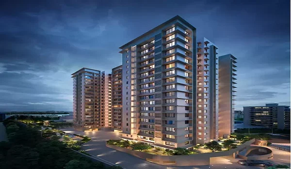
Sattva Aangane stands on six survey numbers in Bandapura Village, in the Bidrahalli Hobli of Bengaluru East Taluk. The parcels are Sy No. 23/1B, 23/2, 24/1C, 24/2B, 25/2 and 26/2, and together they measure 10 acres 9 guntas. As per the K-RERA filing, every parcel has a registered sale deed, a conversion order, a joint development agreement and an e-khatha. The promoter has also filed a sworn statement that no case is pending on the land.

The sections below break down each parcel and trace the title back to 2010. They also flag two points a careful buyer should raise with a lawyer.
Survey Number-Wise Land Extent at Bandapura


Here is every parcel exactly as the promoter filed it with K-RERA. We have added the acre figure for easy reading, since 40 guntas make one acre.

Survey No. Extent (as filed) Approx. acres Land owner Conversion type
23/1B 1 acre 34 guntas 1.85 Sattva Resi Private Limited Residential
23/2 1 acre 10 guntas 1.25 Sattva Realtors Private Limited Residential
24/1C 2 acres 1 gunta 2.03 Sattva Realtors Private Limited Commercial
24/2B 34 guntas 0.85 Sattva Realtors Private Limited Commercial
25/2 1 acre 28 guntas 1.70 Sattva Realtors Private Limited Residential
26/2 2 acres 22 guntas 2.55 Sattva Realtors Private Limited Residential
Total 10 acres 9 guntas 10.23

Sy No. 26/2 is the largest parcel at 2 acres 22 guntas, while 24/2B is the smallest at just 34 guntas. Sattva Realtors owns five of the six parcels, and Sattva Resi owns the sixth. The filing marks all of them as land bought outright, not held on lease or received as a gift.

Who Owned the Land Before Sattva?


All six parcels came to the Sattva companies through one sale deed, number 2873/2010-11. The deed was registered on 18 August 2010 at the Sub-Registrar Office in Bidarahalli. Sanyo BPL Private Limited sold the land, and Sattva Realtors Private Limited bought it.

One deed for the whole site keeps the title chain short, which makes life easier for your bank's lawyer. There is no long string of small owners to trace, and no gap where a parcel changed hands without a record.

On 2 December 2025, the owners signed a joint development agreement at the Banaswadi Sub-Registrar Office. This JDA covers the full extent of the site and names Sattva Resi Private Limited as the promoter. So the company on your sale agreement will be Sattva Resi, even though the site hoarding carries the Sattva Group brand.
Which Parcels Have Residential or Commercial Conversion?


Before anyone can build homes on farm land in Karnataka, the Deputy Commissioner must issue a conversion order. The Bangalore District DC issued the orders for this site in two batches, nine years apart.
  • Sy No. 23/2, 26/2, 25/2 and 23/1B got residential conversion on 24 June 2024, under order numbers 20864 to 20867.
  • Sy No. 24/1C and 24/2B got commercial conversion on 20 May 2015, under order number ALN(EBK)SR/65/14-15.

The two commercial parcels add up to 2 acres 35 guntas, which is close to 28% of the site. The BDA sanctioned a residential plan for the whole site on 2 February 2026, and that sanction covers these parcels too. Even so, this is a fair first question to put to your lawyer before you sign.

Does the Land Have an E-Khatha and Plan Approval?


Yes, it has both. The PDO of Doddabanahalli village panchayat issued an e-khatha for the site on 15 January 2026. The filing shows the same khatha number, 150200401300600057, against all six survey numbers. This suggests the local body now records the site as one single property.

The Bangalore Development Authority sanctioned the building plan under number BDA/NAMA/AA.SA/A.A-5/TA.SA-4/PU/66/2025-26. The promoter has also filed a nil litigation affidavit, stating that no case is pending on the land, property or khatha. You can download this affidavit from the RERA portal as Annexure 49.

Where Exactly Is the Land?


The boundary schedule in the filing tells you what sits on each side of the site.

  • North: National Highway 75, which is Old Madras Road
  • South: Land bearing Sy No. 18
  • East: Private property
  • West: Land bearing Sy No. 25/1, 26/1 and the Peripheral Ring Road (PRR)

The filing places the site at latitude 13.039249 and longitude 77.742784. Type these two numbers into Google Maps, and you can see the plot before your site visit. The highway on the north gives the site direct road access. The PRR on the west will add a second link once the ring road is built.

Why Does the RERA Land Area Look Smaller?


You may spot two land figures that do not quite match. The six survey extents add up to 10 acres 9 guntas, or about 41,380 sq m. The RERA area section, though, lists the total land area as 40,441 sq m, which is about 9.99 acres.

The gap works out to roughly 940 sq m. Gaps like this often come from land kept aside for road widening or set-backs. The filing does not give the reason, so ask the sales team to explain it to you in writing.

How Can You Verify These Records Yourself?


You should not rely on any website for land details, including this one. These five checks take a few hours and give you first-hand proof.

  • Search PRM/KA/RERA/1251/446/PR/180926/008944 on rera.karnataka.gov.in and download the land annexures.
  • Check the RTC for each survey number on the Bhoomi portal, which shows the current owner and land type.
  • Read the mutation records, which show how the ownership changed over the years.
  • Pull a fresh encumbrance certificate from the Kaveri portal to rule out any loan against the land.
  • Hand every document to a property lawyer before you sign the agreement for sale.

What Do These Land Records Mean for Your Purchase?


Clean land papers decide whether your bank sanctions the loan, whether your sale deed registers smoothly and how easily you can resell later. At Sattva Aangane, the records show one parent deed, completed conversion, a registered JDA and an e-khatha. That is a stronger starting point than many new launches along the Budigere Cross belt.

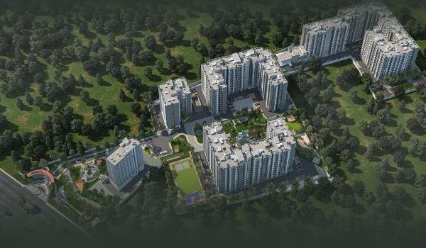
The land also shapes daily life once you move in. Of the 40,441 sq m site, about 34,098 sq m stays open, which works out to roughly 84%. To see how the towers, clubhouse and green zones sit across these six parcels, visit the Sattva Aangane Master Plan page.

FAQs


1. What are the survey numbers of Sattva Aangane?

Sattva Aangane stands on Sy No. 23/1B, 23/2, 24/1C, 24/2B, 25/2 and 26/2 in Bandapura Village, Bengaluru East Taluk.

2. What is the total land area of Sattva Aangane?

The six survey extents add up to 10 acres 9 guntas. The RERA area section lists 40,441 sq m, or about 9.99 acres.

3. Who owns the land under Sattva Aangane?

Sattva Realtors owns five parcels and Sattva Resi owns Sy No. 23/1B. Sattva Resi builds the project as promoter under a JDA.

4. Does Sattva Aangane have an e-khatha?

Yes. Doddabanahalli village panchayat issued the e-khatha on 15 January 2026, with one khatha number for all six parcels.

5. Is there any court case on the Sattva Aangane land?

The promoter has filed a nil litigation affidavit with K-RERA, stating that no case is pending on the land or khatha.

6. How can I check the Sattva Aangane land papers online?

Search the RERA number on rera.karnataka.gov.in, then cross-check the RTC on Bhoomi and the encumbrance certificate on Kaveri.

Sattva Aangane Blog


Enquiry
Enquire Now